Andrew's Mill Pond Trail
Gallery
Quick Facts
| Difficulty | easy |
| Trail Type | linear |
| Distance | 1.8 km one way |
| Estimated Time | 1 hour |
| Surface Type | crushed rock |
| Elevation Change | 11 meters |
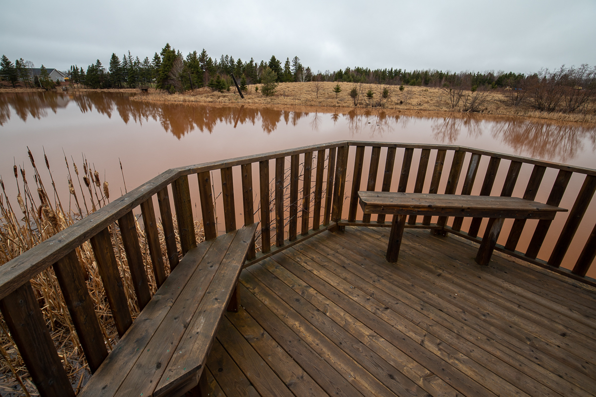
| Features | pond, interpretive signs |
| Trail Markers | none but easy to follow |
| Scenery Rating | beautiful |
| Maintenance Rating | well maintained |
| Cell Reception | strong |
| Dog Friendly | on a leash |
| Fees | none |
Store

Map
Directions
From the intersection of the Trans-Canada Highway (route 1) and St. Peters Road in Charlottetown, drive north on St. Peters Road. Drive for 700 meters and you will cross a small causeway. On the left, just past the causeway, you will find a wide area along the road to park.

St. Peters Road can be a busy road and there is not much room to park. A better access point is to continue another 200 meters to the next road on the left (MacRae Drive). After 350 meters you will find a ballfield on the left. Park here and follow the trail along the left side of the ballfield. The trail enters the woods at the back left of the field.
Description
The Andrew's Mill Pond Trail is a short trail but what it lacks in distance, it makes up for in history and nature. The history of the area is extensive and goes back several hundred years. The interpretive signs explain the history of the causeway that crosses the pond at St. Peters Road (below), the history of the fox breeding in the area, and a glimpse at the history of the pond and the surrounding East Royalty.
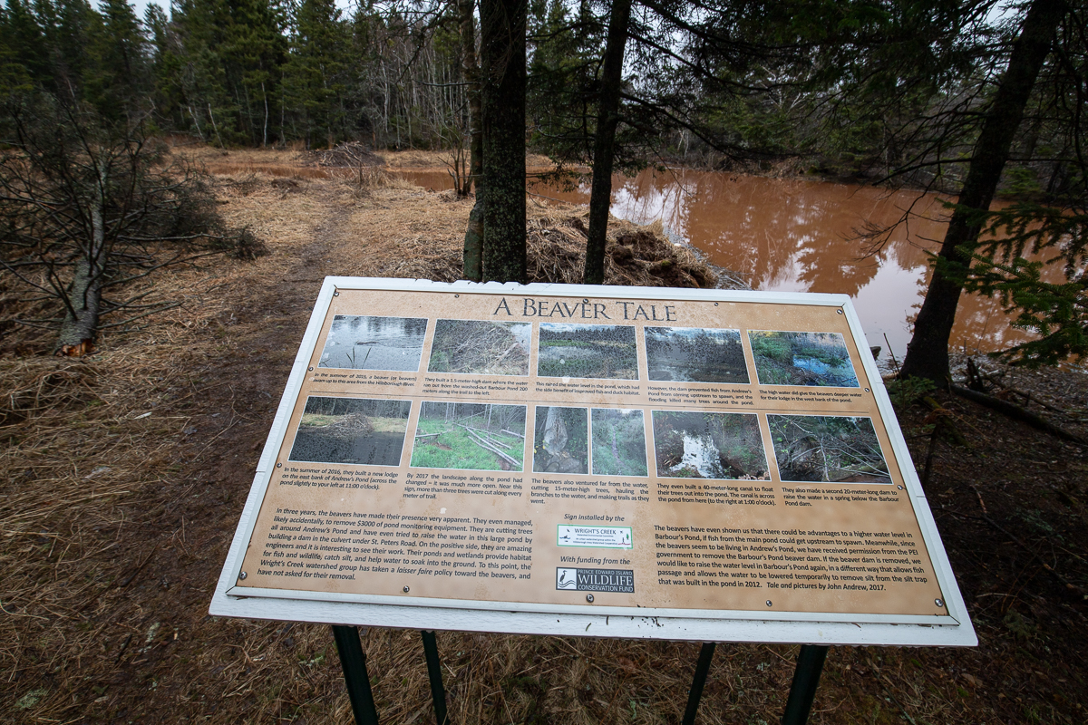
The wildlife that can be found in and around the pond is also extensive. Interpretive signs describe the waterfowl that can be found in the pond. An interpretive sign near a beaver hut tells the story of the beavers who built the hut and a nearby dam. Another intpretive sign tells of the importance of riparian zones on streams. When I was there I saw several ducks on the pond and songbirds in the trees around the pond. I didn't get a chance to see the beavers.
From the Sign
Building Bridges
Pont de la Riviere de L'ile au Foin
St. Peters Road was constructed by the French settlers sometime after 1720. By the 1750s, it was a significant travel route from St. Peters to Port LaJoie (later Fort Amherst) and is shown below on the 1760 French map of Ile Saint Jean, prior to the founding of Charlottetown. The road would have had to cross this watercourse, which, in the French era, was known as la Rivière de L'ile au Foin (River of the Isle of Hay). In 2013 and 2014, excavators were used to remove sediment from this pond. About 100 meters north of here, the remains of large rectangular boxes, made from logs and filled with clay and rock, were found. They were buried in the mud below the pond on each side of the channel through the pond. This cribwork would have supported a bridge likely used by the French and initially by the English. This location would have been a reasonable bridge location because, south of this point, the creek was in a ravine or there was marsh mud, making bridging the creek more difficult. During the 2013-14 excuvation work, three of the dozens of logs from the cribwork were erected as posts to show the bridge location. They can be seen from here on the sides of the pond. The bridge location is also shown as #1 on the aerial photograph to the right.
From the Sign
Building Bridges
The Causeway
In 1928, the one-lane iron bridge was replaced by a causeway. Four months into the project, there was an editorial in the Guardian newspaper critical of the length of time the project was taking. Moving large amounts of clay was difficult in those days and mostly done by teams of horses. Since part of the project lowered St. Peters Road into cuttings in the hills on each side of the pond (#4 and #5), it is likely that this clay was used to fill in the pond. A large wooden culvert was built to allow the water to flow freely under the roadway. During construction, traffic crossed the pond by using the mill dam (#2), the Mill Road (#7), later called the "High Road". Later it was found that the cuttings filled with drifting snow in winter, especially on the Charlottetown side, and the "High Road" was used for travel when necessary.
Since 1928, the wooden culvert through the causeway has been replaced by a concrete and steel culvert, the pond has been filled in to make the causeway much wider and higher, the road has been paved, and the cuttings to each side have been removed. However, many people still refer to this location on the highway as Wright's Bridge.
From the Sign
Building Bridges
Wright's Bridge
When Thomas Wright surveyed Charlottetown in 1771, he divided the Charlottetown Royalty into 12-acre pasture lots, and in the process, defined the location of St. Peters Road (see below). The map shows St. Peters Road, as it crosses what the English then called Bird Island Creek, to be in its present location and not 100 meters to the north where the cribwork was found. Just when the bridge was moved is uncertain. However, when John Cambridge purchased about 300 acres along the creek in 1786, and circa 1800, built a milling complex (#2 on the aerial photo), he flooded about 12 acres of his property along the creek on both sides of St. Peters Road. A new longer bridge would then have been needed to cross the pond and it would likely have been built a few feet behind you (#3 on the aerial photo). (Perhaps Cambridge built this bridge, as his flooding had caused the problem.) There are government records from the mid-1800s of bridges being rebuilt. A one-lane iron bridge, the kind you drvie through, was present in the early 1900s. In 1808, Cambridge had turned the mill property over to George Wright, his son-in-law, and the bridge came to be known as Wright's Bridge.


From the Sign
This is just a sample of the intpretive signs along this trail. You will have to visit the trail to read the rest.
External Links
Trail Last Hiked: July 12, 2018.
Page Last Updated: April 14, 2019.