Victoria Park Boardwalk
Gallery

Quick Facts
| Difficulty | wheelchair |
| Trail Type | linear |
| Distance | 1.3 km |
| Estimated Time | 1 hour |
| Surface Type | boardwalk |
| Elevation Change | 3 meters |
| Features | bay, historic site |
| Trail Markers | none but easy to follow |
| Scenery Rating | beautiful |
| Maintenance Rating | well maintained |
| Cell Reception | strong |
| Dog Friendly | on a leash |
| Fees | none |
Store

Description
Victoria Park is a beautiful park that is situated on a point where three rivers come together and flow out through a narrow passage into the Northumberland Strait. There is a historic site with canons half way around the boardwalk. From this point the canons could easily protect the harbour from any ships trying to enter through the narrow passage. The boardwalk loops around the point. The park is situated in the center of the city with the bay on three sides and the city to the north.
Map
Directions
To get to the park drive into the city on University Avenue. Near the city center turn right on Euston Street. After 500 meters turn left onto Terry Fox Drive. Turn left and find a place to park along Kent Street. The boardwalk starts right off the end of Terry Fox Drive on the right.
To park at the other end of the boardwalk keep right on Euston Street as it turns into Brighton Road (Just past Terry Fox Drive). At the end of the street turn left onto Victoria Park Roadway and park along the road on the right. The boardwalk travels along this road.
From the Sign
Port Lajoie / Fort Amherst
Located across the water, on the right hand side of the harbour entrance, was the focal point of mid 18th century history of this Island, then called Isle St. Jean. From there, Acadian settlers moved up and down the rivers and tried to carve a place of peace in a new land, helped by the experience of the Mi'kmaq. It became the point of entry and a shipping port for the Acadians, as well as providing a military presence for the new settlement. It was all short lived for after the final fall of Louisburg in 1758, the Island came under British Rule. The heart broken Acadians were carried into exile except for a small number who escaped to the woods. The French Regime on the Isle St. Jean had come to an end.

The British regime began in 1763 and was marked by the arrival of a small garrison of men. Shortly thereafter Capt. Samuel Holland, Surveyor General for British North America, established his camp in a small cove to the southwest of the harbour. Capt. Holland surveyed this Island into 67 Lots, fourteen parishes and three counties. He anglicized some of the early Mi'kmaq and Acadian names and named many new sites after friends, members of the Royal Family and prominent Englishmen. Port Lajoie was renamed Fort Amherst.
It was from Fort Amherst that the new colony was directed and defended under the command of the first governor of the Island, Walter Patterson. After the laying out of the new capital of Charlotte Town in 1778, the settlers moved across the water to this side and the settlement of our town began.
Today Port Lajoie/Fort Amherst, that special piece of land across the water is a National Park. Archeological investigation is periodically carried out to confirm details of earlier times.
From the Sign
Victoria Park
Victoria Park, named in honour of Queen Victoria, covers almost 50 acres of land. It is a part of a farm, called Fanning Bank, set aside by Governor Fanning in 1793, as a site to build a home and provide a place of leisure for the Governor. Government House was built there in 1834, and still dominates the site. It is one of the finest Government Houses in the country. In 1873 the larger area was declared a public park "..for the sole purpose of a park, promenade and pleasure ground for the use of its citizens... such things as circus shows, exhibitions of any kind are forbidden."
PRINCE EDWARD BATTERY
Moved to this site about 1805, the Prince Edward Battery was part of the defence system for the town. Although its six guns have never been called on for any defensive action, it has often been used for ceremonial occasions.
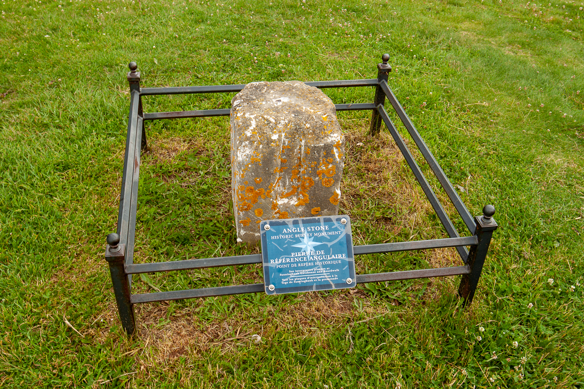
SURVEYING CHARLOTTETOWN
Land surveying in a new territory was always taken seriously. To assure the accuracy of the surveying equipment a meridional line was established here in 1820. The three granite stones and a cannon barrel, spaced appropriately can still be seen in Victoria Park.

Trail Last Hiked: July 12, 2018.
Page Last Updated: April 14, 2019.